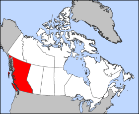
British_Columbia-map.png(280 × 230 படவணுக்கள், கோப்பின் அளவு: 14 KB, MIME வகை: image/png)

இது விக்கிமீடியா பொதுக்கோப்பகத்தில் இருக்கும் ஒரு கோப்பாகும். இக்கோப்பைக் குறித்து அங்கே காணப்படும் படிம விளக்கப் பக்கத்தை இங்கே கீழே காணலாம்.
பொதுக்கோப்பகம் ஒரு கட்டற்ற கோப்புகளின் சேமிப்பகமாகும். நீங்களும் உதவலாம்.

Template loop detected: Template:Autotranslate <includeonly></includeonly> Map of British Columbia

Projection: Lambert azimuthal equal-area

Geospatial data from: The Atlas of Canada, The National Atlas of the United States archive copy at the Wayback Machine and U.S. Geological Survey

Cartographer: John Fowler

Public domain I, the copyright holder of this work, release this work into the public domain. This applies worldwide.
சில நாடுகளில் இது சாத்தியமில்லாது போகலாம். அவ்வாறாயின் :
I grant anyone the right to use this work for any purpose, without any conditions, unless such conditions are required by law.

Captions

Add a one-line explanation of what this file represents

Items portrayed in this file

depicts ஆங்கிலம்

checksum ஆங்கிலம்

4b584c7e97bdcd87e8f54e9f725298d1d90aab67

data size ஆங்கிலம்

14,811 பைட்டு

230 படவணு

280 படவணு

கோப்பின் வரலாறு

குறித்த நேரத்தில் இருந்த படிமத்தைப் பார்க்க அந்நேரத்தின் மீது சொடுக்கவும்.

நாள்/நேரம்நகம் அளவு சிறுபடம்அளவுகள்பயனர்கருத்து
தற்போதைய12:12, 24 மார்ச்சு 200512:12, 24 மார்ச்சு 2005 இலிருந்த பதிப்புக்கான சிறு தோற்றம்280 × 230 (14 KB)VoyagerMap of British Columbia Projection: Lambert azimuthal equal-area Geospatial data from: [http://atlas.gc.ca/ The Atlas of Canada], [http://www.nationalatlas.gov/ The National Atlas of the United States] and [http://www.usgs.gov U.S. Geological Survey] C

இப் படிமத்துக்கு இணைக்கப்பட்டுள்ள பக்கங்கள் எதுவும் இல்லை.

கோப்பின் முழுமையான பயன்பாடு

கீழ்கண்ட மற்ற விக்கிகள் இந்த கோப்பை பயன்படுத்துகின்றன:

"https://ta.wikipedia.org/wiki/படிமம்:British_Columbia-map.png" இலிருந்து மீள்விக்கப்பட்டது