படிமம்:Madhya Pradesh in India.png
Madhya_Pradesh_in_India.png (350 × 426 படவணுக்கள், கோப்பின் அளவு: 76 KB, MIME வகை: image/png)
| இது விக்கிமீடியா பொதுக்கோப்பகத்தில் இருக்கும் ஒரு கோப்பாகும். இக்கோப்பைக் குறித்து அங்கே காணப்படும் படிம விளக்கப் பக்கத்தை இங்கே கீழே காணலாம்.
|

|
This locator map image could be re-created using vector graphics as an SVG file. This has several advantages; see Commons:Media for cleanup for more information. If an SVG form of this image is available, please upload it and afterwards replace this template with
{{vector version available|new image name}}.
It is recommended to name the SVG file “Madhya Pradesh in India.svg”—then the template Vector version available (or Vva) does not need the new image name parameter. |
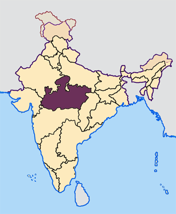
--- Map made by me, Nichalp --- Note: The Indian state of w:Jammu and Kashmir is claimed by w:India, w:Pakistan and the w:People's Republic of China. This map depicts the boundaries of the state as it was in 1947. Areas administered by India is coloured as per the rest of the states, and the area administered by Pakistan and China are coloured in a neutral colour. See the map of Jammu and Kashmir.
The Indian state of w:Arunachal Pradesh is claimed by China as a part of w:South Tibet. The claimed region is depicted in a pale shade of pink. See the map of Arunachal Pradesh.
The Indian territorial waters extend to a distance of twelve nautical miles.

|
GNU Free Documentation License விதிமுறைகளின் கீழ் இந்த ஆவணத்தை நகலெடுக்க, விநியோகிக்க மற்றும்/அல்லது மாற்றுவதற்கு அனுமதி வழங்கப்பட்டுள்ளது, Free Software Foundation;ஆல் வெளியிடப்பட்ட பதிப்பு 1.2 அல்லது அதற்குப் பிந்தைய பதிப்பு, மாற்றமில்லாத பிரிவுகள், முன் அட்டை உரைகள் மற்றும் பின் அட்டை உரைகள் இல்லாமல் வெளியிடப்பட்டது. GNU Free Documentation License என்ற தலைப்பில் உரிமத்தின் நகல் சேர்க்கப்பட்டுள்ளது. |
| இந்த கோப்பு Creative Commons Attribution-Share Alike 3.0 Unported உரிமத்தின் கீழ் உள்ளது. | ||
| ||
| This licensing tag was added to this file as part of the GFDL licensing update. |
கோப்பின் வரலாறு
குறித்த நேரத்தில் இருந்த படிமத்தைப் பார்க்க அந்நேரத்தின் மீது சொடுக்கவும்.
| நாள்/நேரம் | நகம் அளவு சிறுபடம் | அளவுகள் | பயனர் | கருத்து | |
|---|---|---|---|---|---|
| தற்போதைய | 07:30, 23 ஏப்பிரல் 2005 | | 350 × 426 (76 KB) | Nichalp | NPOV map |
| 07:21, 23 ஏப்பிரல் 2005 |  | 200 × 231 (22 KB) | Kerpal | Reverted to earlier revision | |
| 06:23, 23 ஏப்பிரல் 2005 |  | 500 × 608 (121 KB) | Nichalp | Reverted to earlier revision | |
| 05:00, 23 ஏப்பிரல் 2005 |  | 200 × 231 (22 KB) | Kerpal | Reverted to earlier revision | |
| 04:54, 23 ஏப்பிரல் 2005 |  | 500 × 608 (121 KB) | Nichalp | Reverted to earlier revision | |
| 21:05, 22 ஏப்பிரல் 2005 |  | 200 × 231 (22 KB) | Kerpal | Reverted to earlier revision | |
| 13:39, 22 ஏப்பிரல் 2005 |  | 500 × 608 (121 KB) | Nichalp | Reverted to earlier revision | |
| 09:48, 22 ஏப்பிரல் 2005 |  | 200 × 231 (22 KB) | Kerpal | originally by en:User:Morwen | |
| 18:00, 21 ஏப்பிரல் 2005 |  | 500 × 608 (121 KB) | Nichalp | --- Map made by me, ~~~ --- Note: The Indian state of w:Jammu and Kashmir is claimed by w:India, w:Pakistan and the w:People's Republic of China. This map depicts the boundaries of the state as it was in 1947. Areas administered by India |
கோப்பு பயன்பாடு
பின்வரும் பக்க இணைப்புகள் இப் படிமத்துக்கு இணைக்கபட்டுள்ளது(ளன):
கோப்பின் முழுமையான பயன்பாடு
கீழ்கண்ட மற்ற விக்கிகள் இந்த கோப்பை பயன்படுத்துகின்றன:
- br.wikipedia.org-திட்டத்தில் இதன் பயன்பாடு
- bxr.wikipedia.org-திட்டத்தில் இதன் பயன்பாடு
- en.wikipedia.org-திட்டத்தில் இதன் பயன்பாடு
- User:Tanul
- Template:User Madhya Pradesh
- Jai Prakash Yadav (cricketer)
- User:Suyash
- User:Tanul/Userboxes
- User:Siddhant
- Dharampuri
- User:Chintu rohit
- 2004 Indian general election in Madhya Pradesh
- Wikipedia:WikiProject Madhya Pradesh
- Raja Hindu Rao
- User:!dea4u
- 2009 Indian general election in Madhya Pradesh
- Bindeshwari Goyal
- User:Gaurav713
- Template:MadhyaPradesh-stub
- Category:Madhya Pradeshi Wikipedians
- User:Abhinay.leo
- Template:User Madhya Pradesh/doc1
- User:Shobhit Gosain
- 2013 elections in India
- User:!dea4u/userboxes
- User:Suyash.dwivedi
- Bhima Kheda
- Nikhil Thakur
- User:Dr.Rohit Bhamoura
- Mukhya Mantri Yuva Swarozgar Yojana
- User:Brandybradham
- User:Har$h/sandbox
- User:Jaywardhan009
- List of speakers of the Madhya Pradesh Legislative Assembly
- User:Brandybradham/testcases
- User:Shreya.Bhopal
- User:Swapnil.Karambelkar
- User:Siddharth.Mishra
- User:Vijay Tiwari09
- User:Kiran.Dwivedi
- Newton Chikli Colliery disaster
- Nagjhiri
- Dewas Gate Inter State Bus Stand
- 2014 Indian general election in Madhya Pradesh
- Bicholi Hapsi
- Raigaon Assembly constituency
- Semariya Assembly constituency
- Mangawan Assembly constituency
- Manpur Assembly constituency
- Panagar Assembly constituency
- Sihora Assembly constituency
சிறப்பு பக்கம்-மொத்த பயன்பாடு - இதன் மூலம் இந்த கோப்பின் மொத்த பயன்பாட்டை அறிய முடியும்