படிமம்:Mexico states map small.png
இதைவிட அளவில் பெரிய படிமம் இல்லை.
Mexico_states_map_small.png (450 × 312 படவணுக்கள், கோப்பின் அளவு: 72 KB, MIME வகை: image/png)
| இது விக்கிமீடியா பொதுக்கோப்பகத்தில் இருக்கும் ஒரு கோப்பாகும். இக்கோப்பைக் குறித்து அங்கே காணப்படும் படிம விளக்கப் பக்கத்தை இங்கே கீழே காணலாம்.
|

|
This locator map image could be re-created using vector graphics as an SVG file. This has several advantages; see Commons:Media for cleanup for more information. If an SVG form of this image is available, please upload it and afterwards replace this template with
{{vector version available|new image name}}.
It is recommended to name the SVG file “Mexico states map small.svg”—then the template Vector version available (or Vva) does not need the new image name parameter. |
சுருக்கம்
| விளக்கம் |
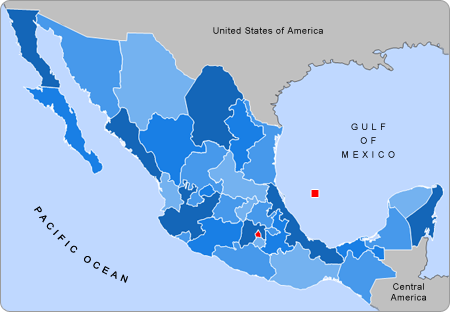
English: Small map of Mexico in use in the clickable map in various Wikipedias |
| மூலம் | Alex Covarrubias |
| ஆசிரியர் | AlexCovarrubias |
அனுமதி
| This work has been released into the public domain by its author, AlexCovarrubias at ஆங்கிலம் விக்கிப்பீடியா. This applies worldwide. சில நாடுகளில் இது சாத்தியமில்லாது போகலாம். அவ்வாறாயின் : AlexCovarrubias grants anyone the right to use this work for any purpose, without any conditions, unless such conditions are required by law. |
Original upload log
The original description page was here. All following user names refer to en.wikipedia.
- 2007-09-28 04:55 AlexCovarrubias 450×312× (74224 bytes) Changed border color (same used by Wikipedia thumbs)
- 2007-09-28 04:52 AlexCovarrubias 450×312× (73917 bytes) Rounded borders
- 2007-03-16 17:35 AlexCovarrubias 450×312× (65230 bytes)
- 2007-03-16 17:28 AlexCovarrubias 450×312× (69110 bytes) == Summary == Political division of Mexico. Map created for the [[Template:Mexico Labelled Map small]]. Designed by [[User:AlexCovarrubias|Alex Covarrubias]] == Licensing == {{PD-self}}
கோப்பின் வரலாறு
குறித்த நேரத்தில் இருந்த படிமத்தைப் பார்க்க அந்நேரத்தின் மீது சொடுக்கவும்.
| நாள்/நேரம் | நகம் அளவு சிறுபடம் | அளவுகள் | பயனர் | கருத்து | |
|---|---|---|---|---|---|
| தற்போதைய | 17:55, 23 ஆகத்து 2009 | | 450 × 312 (72 KB) | Feydey | update |
| 22:13, 27 ஆகத்து 2007 |  | 450 × 312 (64 KB) | AlexCovarrubias | {{Information |Description=Small map of Mexico in use in the clickable map in various Wikipedias |Source=Alex Covarrubias |Date= |Author= AlexCovarrubias }} |
கோப்பு பயன்பாடு
பின்வரும் 2 பக்கங்கள் இணைப்பு இப் படிமத்துக்கு இணைக்கபட்டுள்ளது(ளன):
கோப்பின் முழுமையான பயன்பாடு
கீழ்கண்ட மற்ற விக்கிகள் இந்த கோப்பை பயன்படுத்துகின்றன:
- an.wikipedia.org-திட்டத்தில் இதன் பயன்பாடு
- bn.wikipedia.org-திட்டத்தில் இதன் பயன்பாடு
- ca.wikipedia.org-திட்டத்தில் இதன் பயன்பாடு
- en.wikipedia.org-திட்டத்தில் இதன் பயன்பாடு
- hu.wikipedia.org-திட்டத்தில் இதன் பயன்பாடு
- pnb.wikipedia.org-திட்டத்தில் இதன் பயன்பாடு
- pt.wikipedia.org-திட்டத்தில் இதன் பயன்பாடு
- ur.wikipedia.org-திட்டத்தில் இதன் பயன்பாடு
- vi.wikipedia.org-திட்டத்தில் இதன் பயன்பாடு
- zh.wikipedia.org-திட்டத்தில் இதன் பயன்பாடு