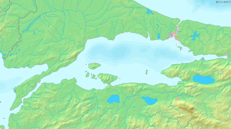
படிமம்:Sea of Marmara map.png

இந்த முன்னோட்டத்தின் அளவு: 800 × 448 படப்புள்ளிகள் . மற்ற பிரிதிறன்கள்: 320 × 179 படப்புள்ளிகள் | 640 × 358 படப்புள்ளிகள் | 1,336 × 748 படப்புள்ளிகள் .
மூலக்கோப்பு (1,336 × 748 படவணுக்கள், கோப்பின் அளவு: 334 KB, MIME வகை: image/png)
கோப்பின் வரலாறு
குறித்த நேரத்தில் இருந்த படிமத்தைப் பார்க்க அந்நேரத்தின் மீது சொடுக்கவும்.
| நாள்/நேரம் | நகம் அளவு சிறுபடம் | அளவுகள் | பயனர் | கருத்து | |
|---|---|---|---|---|---|
| தற்போதைய | 17:37, 6 செப்டெம்பர் 2005 |  | 1,336 × 748 (334 KB) | Mats Halldin~commonswiki | Map of the Sea of Marmara Bounding box West 26°, South 39.8°, East 30°, North 41.5°. {{demis-pd}} Category:Maps of Turkey |
கோப்பு பயன்பாடு
பின்வரும் பக்க இணைப்புகள் இப் படிமத்துக்கு இணைக்கபட்டுள்ளது(ளன):
கோப்பின் முழுமையான பயன்பாடு
கீழ்கண்ட மற்ற விக்கிகள் இந்த கோப்பை பயன்படுத்துகின்றன:
- af.wikipedia.org-திட்டத்தில் இதன் பயன்பாடு
- am.wikipedia.org-திட்டத்தில் இதன் பயன்பாடு
- ang.wikipedia.org-திட்டத்தில் இதன் பயன்பாடு
- ar.wikipedia.org-திட்டத்தில் இதன் பயன்பாடு
- azb.wikipedia.org-திட்டத்தில் இதன் பயன்பாடு
- az.wikipedia.org-திட்டத்தில் இதன் பயன்பாடு
- ba.wikipedia.org-திட்டத்தில் இதன் பயன்பாடு
- br.wikipedia.org-திட்டத்தில் இதன் பயன்பாடு
- bs.wikipedia.org-திட்டத்தில் இதன் பயன்பாடு
- ca.wikipedia.org-திட்டத்தில் இதன் பயன்பாடு
- ce.wikipedia.org-திட்டத்தில் இதன் பயன்பாடு
- ckb.wikipedia.org-திட்டத்தில் இதன் பயன்பாடு
- cs.wikipedia.org-திட்டத்தில் இதன் பயன்பாடு
- cv.wikipedia.org-திட்டத்தில் இதன் பயன்பாடு
- cy.wikipedia.org-திட்டத்தில் இதன் பயன்பாடு
- da.wikipedia.org-திட்டத்தில் இதன் பயன்பாடு
- de.wikipedia.org-திட்டத்தில் இதன் பயன்பாடு
- diq.wikipedia.org-திட்டத்தில் இதன் பயன்பாடு
- dsb.wikipedia.org-திட்டத்தில் இதன் பயன்பாடு
- el.wikipedia.org-திட்டத்தில் இதன் பயன்பாடு
- el.wiktionary.org-திட்டத்தில் இதன் பயன்பாடு
- en.wikipedia.org-திட்டத்தில் இதன் பயன்பாடு
- en.wiktionary.org-திட்டத்தில் இதன் பயன்பாடு
- eo.wikipedia.org-திட்டத்தில் இதன் பயன்பாடு
- es.wikipedia.org-திட்டத்தில் இதன் பயன்பாடு
- et.wikipedia.org-திட்டத்தில் இதன் பயன்பாடு
- fa.wikipedia.org-திட்டத்தில் இதன் பயன்பாடு
- fi.wikipedia.org-திட்டத்தில் இதன் பயன்பாடு
- fr.wikipedia.org-திட்டத்தில் இதன் பயன்பாடு
சிறப்பு பக்கம்-மொத்த பயன்பாடு - இதன் மூலம் இந்த கோப்பின் மொத்த பயன்பாட்டை அறிய முடியும்