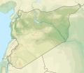
படிமம்:Syria physical location map.svg

Size of this PNG preview of this SVG file: 685 × 599 படப்புள்ளிகள். மற்ற பிரிதிறன்கள்: 274 × 240 படப்புள்ளிகள் | 549 × 480 படப்புள்ளிகள் | 878 × 768 படப்புள்ளிகள் | 1,170 × 1,024 படப்புள்ளிகள் | 2,340 × 2,048 படப்புள்ளிகள் | 921 × 806 படப்புள்ளிகள் .
மூலக்கோப்பு (SVG கோப்பு, பெயரளவில் 921 × 806 பிக்சல்கள், கோப்பு அளவு: 972 KB)
கோப்பின் வரலாறு
குறித்த நேரத்தில் இருந்த படிமத்தைப் பார்க்க அந்நேரத்தின் மீது சொடுக்கவும்.
| நாள்/நேரம் | நகம் அளவு சிறுபடம் | அளவுகள் | பயனர் | கருத்து | |
|---|---|---|---|---|---|
| தற்போதைய | 14:07, 18 நவம்பர் 2022 |  | 921 × 806 (972 KB) | GrandEscogriffe | more correct N/S stretching |
| 20:40, 23 சூலை 2012 |  | 921 × 761 (788 KB) | NordNordWest | == {{int:filedesc}} == {{Information |Description={{de|Physische Positionskarte von Syrien. De-facto-Situation.}} Quadratische Plattkarte, N-S-Streckung 115 %. Geographische Begrenzung der Karte: * N: 37.6° N * S: 32.0° N * W: 34.9... |
கோப்பு பயன்பாடு
பின்வரும் 7 பக்கங்கள் இணைப்பு இப் படிமத்துக்கு இணைக்கபட்டுள்ளது(ளன):
கோப்பின் முழுமையான பயன்பாடு
கீழ்கண்ட மற்ற விக்கிகள் இந்த கோப்பை பயன்படுத்துகின்றன:
- als.wikipedia.org-திட்டத்தில் இதன் பயன்பாடு
- ar.wikipedia.org-திட்டத்தில் இதன் பயன்பாடு
- نهر السن
- بلودان
- الزبداني
- قالب:خريطة مواقع سوريا
- زلزال حلب (1138)
- بحيرة زرزر
- بحيرة قطينة
- مضايا
- زلزال حماة 1157
- وحدة:Location map/data/Syria
- مستخدم:عبد المؤمن/مسودات/خرائط/الشام
- قائمة الصحفيين القتلى في سوريا
- وحدة:Location map/data/Syria/شرح
- الشعيطات
- الخط الزمني للحرب الأهلية السورية (سبتمبر–ديسمبر 2019)
- الخط الزمني للحرب الأهلية السورية (يناير–أبريل 2020)
- الأغاني الحورية
- رقية حسن محمد
- الانتخابات المحلية في الإدارة الذاتية لشمال وشرق سوريا 2015
- الخط الزمني للحرب الأهلية السورية (2022)
- زلزال قهرمان مرعش 2023
- زلزال حلب 1822
- زلزال سوريا 1170
- زلزال سوريا 1344
- زلزال اللاذقية 1796
- زلزال سوريا 1202
- زلزال الساحل السوري 859
- زلزال أنطاكية 526
- زلزال أميك 1872
- arz.wikipedia.org-திட்டத்தில் இதன் பயன்பாடு
- ast.wikipedia.org-திட்டத்தில் இதன் பயன்பாடு
- av.wikipedia.org-திட்டத்தில் இதன் பயன்பாடு
- azb.wikipedia.org-திட்டத்தில் இதன் பயன்பாடு
- az.wikipedia.org-திட்டத்தில் இதன் பயன்பாடு
- ba.wikipedia.org-திட்டத்தில் இதன் பயன்பாடு
சிறப்பு பக்கம்-மொத்த பயன்பாடு - இதன் மூலம் இந்த கோப்பின் மொத்த பயன்பாட்டை அறிய முடியும்
