படிமம்:Uttar Pradesh locator map.svg

Size of this PNG preview of this SVG file: 615 × 599 படப்புள்ளிகள். மற்ற பிரிதிறன்கள்: 246 × 240 படப்புள்ளிகள் | 492 × 480 படப்புள்ளிகள் | 788 × 768 படப்புள்ளிகள் | 1,051 × 1,024 படப்புள்ளிகள் | 2,101 × 2,048 படப்புள்ளிகள் | 909 × 886 படப்புள்ளிகள் .
மூலக்கோப்பு (SVG கோப்பு, பெயரளவில் 909 × 886 பிக்சல்கள், கோப்பு அளவு: 838 KB)
| இது விக்கிமீடியா பொதுக்கோப்பகத்தில் இருக்கும் ஒரு கோப்பாகும். இக்கோப்பைக் குறித்து அங்கே காணப்படும் படிம விளக்கப் பக்கத்தை இங்கே கீழே காணலாம்.
|
சுருக்கம்
| விளக்கம் |
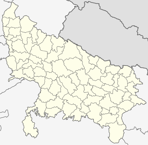
English: This map has been created by Faiz Haider, it is based on Map of Uttar Pradesh on National Portal of India. Equirectangular projection. Geographic limits of the map: top=31.00, bottom=23.50, left=76.60, right=85.00. |
| நாள் | 10 பெப்பிரவரி 2009 (original upload date) |
| மூலம் | Transferred from en.wikipedia to Commons by Hanhil using CommonsHelper. |
| ஆசிரியர் | Faizhaider at ஆங்கிலம் விக்கிப்பீடியா |
அனுமதி
| This work has been released into the public domain by its author, Faizhaider at ஆங்கிலம் விக்கிப்பீடியா. This applies worldwide. சில நாடுகளில் இது சாத்தியமில்லாது போகலாம். அவ்வாறாயின் : Faizhaider grants anyone the right to use this work for any purpose, without any conditions, unless such conditions are required by law. |
Original upload log
The original description page was here. All following user names refer to en.wikipedia.
- 2009-02-10 08:49 Faizhaider 2400×2515× (140024 bytes) This map has been created by [[User:Faizhaider|me]], it is based on [http://india.gov.in/maps/up.php Map of Uttar Pradesh on National Portal of India].
கோப்பின் வரலாறு
குறித்த நேரத்தில் இருந்த படிமத்தைப் பார்க்க அந்நேரத்தின் மீது சொடுக்கவும்.
| நாள்/நேரம் | நகம் அளவு சிறுபடம் | அளவுகள் | பயனர் | கருத்து | |
|---|---|---|---|---|---|
| தற்போதைய | 03:11, 8 சனவரி 2021 | | 909 × 886 (838 KB) | C1MM | Updated districts, made more accurate boundaries |
| 23:32, 6 மார்ச்சு 2011 |  | 2,400 × 2,515 (137 KB) | Plasticspork | Use more neutral colouring | |
| 21:34, 5 நவம்பர் 2009 |  | 2,400 × 2,515 (137 KB) | File Upload Bot (Magnus Manske) | {{BotMoveToCommons|en.wikipedia|year={{subst:CURRENTYEAR}}|month={{subst:CURRENTMONTHNAME}}|day={{subst:CURRENTDAY}}}} {{Information |Description={{en|This map has been created by Faiz Haider, it is based on [http://india.gov.in/m |
கோப்பு பயன்பாடு
பின்வரும் 22 பக்கங்கள் இணைப்பு இப் படிமத்துக்கு இணைக்கபட்டுள்ளது(ளன):
கோப்பின் முழுமையான பயன்பாடு
கீழ்கண்ட மற்ற விக்கிகள் இந்த கோப்பை பயன்படுத்துகின்றன:
- awa.wikipedia.org-திட்டத்தில் இதன் பயன்பாடு
- bh.wikipedia.org-திட்டத்தில் இதன் பயன்பாடு
- उत्तर प्रदेश
- गोरखपुर जिला
- गाजीपुर जिला
- रसड़ा
- गोरखपुर
- कुशीनगर जिला
- टेम्पलेट:उत्तर प्रदेश
- उत्तर प्रदेश के मंडल सभ के लिस्ट
- औंड़िहार
- रेवती, बलियाँ जिला
- चितबड़ागाँव
- बेल्थरा रोड
- गड़वार
- नगरा
- फेफना
- सहतवार
- उत्तर प्रदेश के जिला सभ के लिस्ट
- टेम्पलेट:Uttar Pradesh topics
- उत्तर प्रदेश पुलिस
- आजमगढ़ मंडल
- गोरखपुर मंडल
- इलाहाबाद मंडल
- वाराणसी मंडल
- जनसंख्या अनुसार उत्तर प्रदेश के शहरन के लिस्ट
- बस्ती मंडल
- आगरा मंडल
- अलीगढ़ मंडल
- ceb.wikipedia.org-திட்டத்தில் இதன் பயன்பாடு
- en.wikipedia.org-திட்டத்தில் இதன் பயன்பாடு
- Uttar Pradesh
- List of districts of Uttar Pradesh
- Urdu literature
- List of chief ministers of Uttar Pradesh
- Administrative divisions of Uttar Pradesh
- User talk:Planemad/Infobox Indian Landmark
- Template:Uttar Pradesh topics
- User:Faizhaider/gallery
- Noida ATS Shootout
- Pratapgarh stampede
- Chak Gharpur
- Climate of Uttar Pradesh
- List of cities in Uttar Pradesh by population
- List of urban agglomerations in Uttar Pradesh
- Uttar Pradesh Tourism
- Clean UP, Green UP
- List of urban local bodies in Uttar Pradesh
- fa.wikipedia.org-திட்டத்தில் இதன் பயன்பாடு
சிறப்பு பக்கம்-மொத்த பயன்பாடு - இதன் மூலம் இந்த கோப்பின் மொத்த பயன்பாட்டை அறிய முடியும்