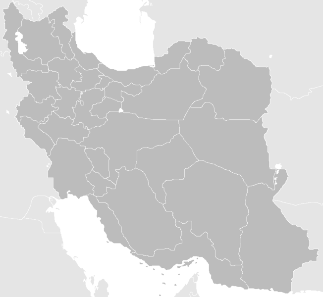
படிமம்:Blank-Map-Iran-With-Water-Bodies.PNG

இந்த முன்னோட்டத்தின் அளவு: 652 × 600 படப்புள்ளிகள் . மற்ற பிரிதிறன்கள்: 261 × 240 படப்புள்ளிகள் | 522 × 480 படப்புள்ளிகள் | 895 × 823 படப்புள்ளிகள் .
மூலக்கோப்பு (895 × 823 படவணுக்கள், கோப்பின் அளவு: 28 KB, MIME வகை: image/png)
| இது விக்கிமீடியா பொதுக்கோப்பகத்தில் இருக்கும் ஒரு கோப்பாகும். இக்கோப்பைக் குறித்து அங்கே காணப்படும் படிம விளக்கப் பக்கத்தை இங்கே கீழே காணலாம்.
|
சுருக்கம்
| விளக்கம் |
English: Blank Map of the territory claimed by Iran With Water Bodies and Neighbors فارسی: نقشه خالی ایران به همراه سرزمینهای آبی و کشورهای همسایه |
| நாள் | |
| மூலம் | self-made adding water bodies and neighbors and applying some corrections and updates to a previous version Image:Blank-Map-Iran.PNG, which in turn was a corrected and updated version of Image:BlankMap-Iran.PNG created and uploaded by Shinas |
| ஆசிரியர் | Siamax |
அனுமதி
| This work has been released into the public domain by its author, I, Siamax. This applies worldwide. சில நாடுகளில் இது சாத்தியமில்லாது போகலாம். அவ்வாறாயின் : I, Siamax grants anyone the right to use this work for any purpose, without any conditions, unless such conditions are required by law. |
கோப்பின் வரலாறு
குறித்த நேரத்தில் இருந்த படிமத்தைப் பார்க்க அந்நேரத்தின் மீது சொடுக்கவும்.
| நாள்/நேரம் | நகம் அளவு சிறுபடம் | அளவுகள் | பயனர் | கருத்து | |
|---|---|---|---|---|---|
| தற்போதைய | 11:33, 23 சூன் 2013 | | 895 × 823 (28 KB) | BasilLeaf | بروزرسانی استانهای یزد و خراسان جنوبی |
| 12:32, 12 நவம்பர் 2010 |  | 895 × 823 (43 KB) | M samadi | Border of South & Razavi Khorasans updated. | |
| 05:07, 18 அக்டோபர் 2010 |  | 895 × 823 (46 KB) | Siamax | Alborz province added | |
| 22:01, 29 சூலை 2007 |  | 895 × 823 (46 KB) | Siamax | == Summary == {{Information |Description=Blank Map of Iran With Water Bodies and Neighbors |Source=self-made adding water bodies and neighbors and applying some corrections and updates to a previous version Image:Blank-Map-Iran.PNG, which in turn wa | |
| 18:39, 29 சூலை 2007 |  | 895 × 823 (46 KB) | Siamax | {{Information |Description=Blank Map of Iran With Water Bodies and Neighbors |Source=self-made adding water bodies and neighbors and applying some corrections and updates to a previous version Image:Blank-Map-Iran.PNG, which in turn was a corrected |
கோப்பு பயன்பாடு
பின்வரும் 2 பக்கங்கள் இணைப்பு இப் படிமத்துக்கு இணைக்கபட்டுள்ளது(ளன):
கோப்பின் முழுமையான பயன்பாடு
கீழ்கண்ட மற்ற விக்கிகள் இந்த கோப்பை பயன்படுத்துகின்றன:
- ar.wikipedia.org-திட்டத்தில் இதன் பயன்பாடு
- av.wikipedia.org-திட்டத்தில் இதன் பயன்பாடு
- ba.wikipedia.org-திட்டத்தில் இதன் பயன்பாடு
- bn.wikipedia.org-திட்டத்தில் இதன் பயன்பாடு
- ce.wikipedia.org-திட்டத்தில் இதன் பயன்பாடு
- ckb.wikipedia.org-திட்டத்தில் இதன் பயன்பாடு
- diq.wikipedia.org-திட்டத்தில் இதன் பயன்பாடு
- el.wikipedia.org-திட்டத்தில் இதன் பயன்பாடு
- en.wikipedia.org-திட்டத்தில் இதன் பயன்பாடு
- Law Enforcement Command of the Islamic Republic of Iran
- User:Siamax
- Template:Provinces of Iran Labelled Map
- User:Jonny-mt/Gallery of current first-level administrative country subdivisions maps
- Outline of Iran
- Administrative divisions of Iran
- Talk:Iran/Archive 11
- List of cities in Iran by province
- User:Reza1615/pdf2
- Borders of Iran
- User:Falcaorib
- eu.wikipedia.org-திட்டத்தில் இதன் பயன்பாடு
- fa.wikipedia.org-திட்டத்தில் இதன் பயன்பாடு
- fi.wikipedia.org-திட்டத்தில் இதன் பயன்பாடு
- hi.wikipedia.org-திட்டத்தில் இதன் பயன்பாடு
- hr.wikipedia.org-திட்டத்தில் இதன் பயன்பாடு
- hu.wiktionary.org-திட்டத்தில் இதன் பயன்பாடு
- id.wikipedia.org-திட்டத்தில் இதன் பயன்பாடு
- is.wikipedia.org-திட்டத்தில் இதன் பயன்பாடு
- ja.wikipedia.org-திட்டத்தில் இதன் பயன்பாடு
சிறப்பு பக்கம்-மொத்த பயன்பாடு - இதன் மூலம் இந்த கோப்பின் மொத்த பயன்பாட்டை அறிய முடியும்