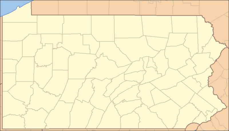
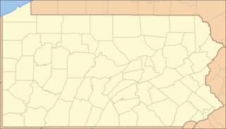
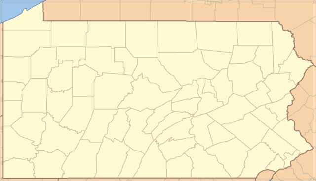
படிமம்:Pennsylvania Locator Map.PNG
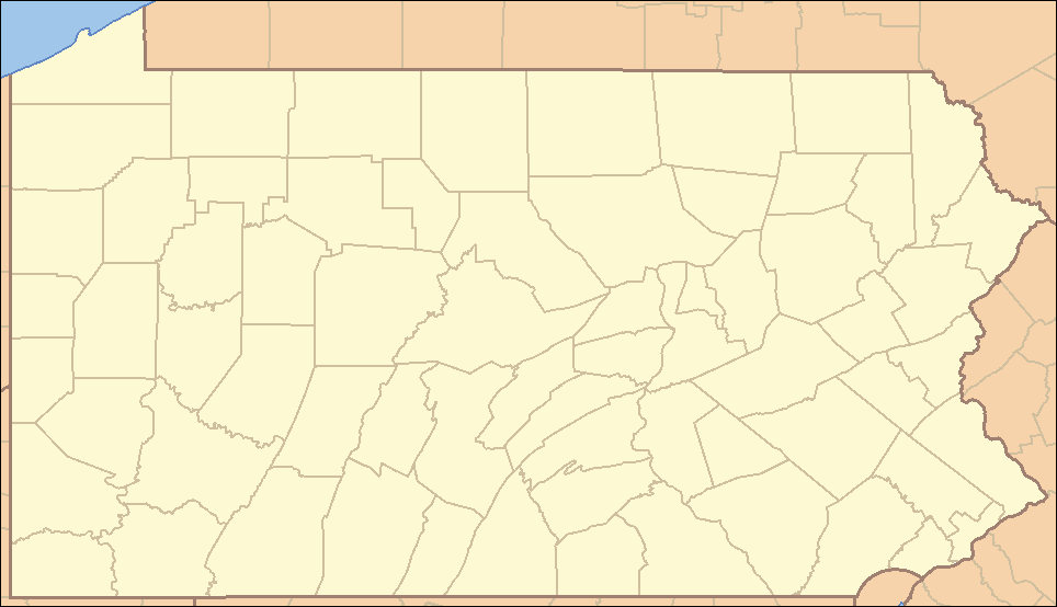
இந்த முன்னோட்டத்தின் அளவு: 800 × 460 படப்புள்ளிகள் . மற்ற பிரிதிறன்கள்: 320 × 184 படப்புள்ளிகள் | 640 × 368 படப்புள்ளிகள் | 964 × 554 படப்புள்ளிகள் .
மூலக்கோப்பு (964 × 554 படவணுக்கள், கோப்பின் அளவு: 13 KB, MIME வகை: image/png)
| இது விக்கிமீடியா பொதுக்கோப்பகத்தில் இருக்கும் ஒரு கோப்பாகும். இக்கோப்பைக் குறித்து அங்கே காணப்படும் படிம விளக்கப் பக்கத்தை இங்கே கீழே காணலாம்.
|
சுருக்கம்
| விளக்கம் | Locator Map of Pennsylvania, United States |
| நாள் | |
| மூலம் | taken from US Census website [1] and modified by User:Ruhrfisch |
| ஆசிரியர் | US Census, Ruhrfisch |
| அனுமதி (இக்கோப்பை மீண்டும் பயன்படுத்துதல்) |
US Census / US Government work is public domain, myations licensed under the GNU Free Documentation License |
| ஒத்தக்கோப்பு |
Derivative works of this file: Location Caln Township.png four (with slightly different color schemes or smaller size), a vector version is at Image:Pennsylvania Locator Map.svg |
அனுமதி
இந்த ஆக்கத்தின் காப்புரிமையாளரான I, Ruhrfisch எனும் நான் இதனைப் பின்வரும் உரிமத்தின் கீழ் வெளியிடுகின்றேன்:

|
GNU Free Documentation License விதிமுறைகளின் கீழ் இந்த ஆவணத்தை நகலெடுக்க, விநியோகிக்க மற்றும்/அல்லது மாற்றுவதற்கு அனுமதி வழங்கப்பட்டுள்ளது, Free Software Foundation;ஆல் வெளியிடப்பட்ட பதிப்பு 1.2 அல்லது அதற்குப் பிந்தைய பதிப்பு, மாற்றமில்லாத பிரிவுகள், முன் அட்டை உரைகள் மற்றும் பின் அட்டை உரைகள் இல்லாமல் வெளியிடப்பட்டது. GNU Free Documentation License என்ற தலைப்பில் உரிமத்தின் நகல் சேர்க்கப்பட்டுள்ளது. |
| இந்த கோப்பு Creative Commons Attribution-Share Alike 3.0 Unported உரிமத்தின் கீழ் உள்ளது. | ||
| பண்புக்கூறுகள்: I, Ruhrfisch | ||
| ||
| This licensing tag was added to this file as part of the GFDL licensing update. |
This file is licensed under the Creative Commons Attribution-Share Alike 2.5 Generic license.
பண்புக்கூறுகள்: I, Ruhrfisch
- நீங்கள் சுதந்திரமாக:
- பகிர்ந்து கொள்ள – வேலையை நகலெடுக்க, விநியோகிக்க மற்றும் அனுப்ப
- மீண்டும் கலக்க – வேலைக்கு பழகிக்கொள்ள.
- கீழ்க்காணும் விதிகளுக்கு ஏற்ப,
- பண்புக்கூறுகள் – நீங்கள் பொருத்தமான உரிமையை வழங்க வேண்டும், உரிமத்திற்கான இணைப்பை வழங்க வேண்டும் மற்றும் மாற்றங்கள் செய்யப்பட்டிருந்தால் குறிப்பிட வேண்டும். நீங்கள் ஏற்புடைய எந்த முறையிலும் அவ்வாறு செய்யலாம், ஆனால் எந்த வகையிலும் உரிமதாரர் உங்களை அல்லது உங்கள் பயன்பாட்டிற்கு ஒப்புதல் அளிக்கும் படி பரிந்துரைக்க கூடாது.
- அதே மாதிரி பகிர் – நீங்கள் ரீமிக்ஸ் செய்தாலோ, உருமாற்றம் செய்தாலோ அல்லது பொருளை உருவாக்கினாலோ, உங்கள் பங்களிப்புகளை அல்லது இணக்கமான உரிமம் கீழ் அசலாக விநியோகிக்க வேண்டும்.
நீர் உமக்கு விருப்பமான உரிமத்தை தேர்ந்தெடுக்கலாம்.
and
This image or file is a work of a United States Census Bureau employee, taken or made as part of that person's official duties. As a work of the U.S. federal government, the image is in the public domain.
|
 |
கோப்பின் வரலாறு
குறித்த நேரத்தில் இருந்த படிமத்தைப் பார்க்க அந்நேரத்தின் மீது சொடுக்கவும்.
| நாள்/நேரம் | நகம் அளவு சிறுபடம் | அளவுகள் | பயனர் | கருத்து | |
|---|---|---|---|---|---|
| தற்போதைய | 22:35, 22 மார்ச்சு 2009 | | 964 × 554 (13 KB) | Mahahahaneapneap | Compressed |
| 15:47, 5 செப்டெம்பர் 2007 |  | 964 × 554 (35 KB) | Ruhrfisch | Very minor fixes of a dozen or so incorrectly colored pixels in the body of the map (no border information pixels changed). All other information the same. | |
| 04:07, 25 ஏப்பிரல் 2007 |  | 964 × 554 (35 KB) | Ruhrfisch | {{Information| |Description= Locator Map of Pennsylvania, United States |Source= taken from US Census website [http://factfinder.census.gov/] and modified by User:Ruhrfisch |Date= April 2007 |Author= US Census, Ruhrfisch |Permission= US Census / US G | |
| 01:25, 23 ஏப்பிரல் 2007 |  | 964 × 554 (35 KB) | Ruhrfisch | {{Information| |Description= Locator Map of Pennsylvania, United States |Source= taken from US Census website [http://factfinder.census.gov/] and modified by User:Ruhrfisch |Date= APril 2007 |Author= US Census, Ruhrfisch |Permission= US Census / US G | |
| 05:07, 9 ஏப்பிரல் 2007 |  | 962 × 552 (35 KB) | Ruhrfisch | {{Information| |Description= Locator Map of Pennsylvania, United States |Source= taken from US Census website [http://factfinder.census.gov/] and modified by User:Ruhrfisch |Date= April 2007 |Author= US Census, Ruhrfisch |Permission= US Census / US G | |
| 04:50, 9 ஏப்பிரல் 2007 |  | 327 × 193 (8 KB) | Ruhrfisch | {{Information| |Description= Locator Map of Pennsylvania, United States |Source= taken from US Census website [http://factfinder.census.gov/] and modified by User:Ruhrfisch |Date= April 2007 |Author= US Census, Ruhrfisch |Permission= US Census / US G | |
| 12:59, 28 சூலை 2006 |  | 288 × 168 (26 KB) | Ruhrfisch | {{Information| |Description= Locator Map of Pennsylvania, United States |Source= taken from US Census website [http://factfinder.census.gov/] and modified by User:Ruhrfisch |Date= July 2006 |Author= US Census, Ruhrfisch |Permission= US Census / US Go |
கோப்பு பயன்பாடு
இப் படிமத்துக்கு இணைக்கப்பட்டுள்ள பக்கங்கள் எதுவும் இல்லை.
கோப்பின் முழுமையான பயன்பாடு
கீழ்கண்ட மற்ற விக்கிகள் இந்த கோப்பை பயன்படுத்துகின்றன:
- ceb.wikipedia.org-திட்டத்தில் இதன் பயன்பாடு
- de.wikipedia.org-திட்டத்தில் இதன் பயன்பாடு
- en.wikipedia.org-திட்டத்தில் இதன் பயன்பாடு
- List of Pennsylvania state parks
- User talk:Decumanus
- User talk:Bcasterline
- User:Ruhrfisch/Sandbox
- User talk:Choess/Archive4
- User talk:Tompw/archive2
- Template:State parks of Pennsylvania map
- User:Ruhrfisch/Pages
- User talk:Ruhrfisch/Archive4
- User talk:Qjuad/Archive 1
- User:IvoShandor/Recognitions
- User talk:VerruckteDan/Archive3
- User talk:Michaelas10/Archive/Archive 04
- User:Gerry D/archive2
- User talk:AceYYC/Archive2
- User talk:IvoShandor/Archive Apr 2007
- User talk:Underneath-it-All/Archive05
- User:Gerry D/archive3
- User talk:VerruckteDan/Archive4
- User:Ruhrfisch
- User talk:AndyZ/Archive 7
- User talk:Zntrip/Archive 1
- User:Sebwite/posmap
- User talk:Nationalparks/Archive 2
- es.wikipedia.org-திட்டத்தில் இதன் பயன்பாடு
- fa.wikipedia.org-திட்டத்தில் இதன் பயன்பாடு
- کربندیل، پنسیلوانیا
- چستر، پنسیلوانیا
- کوتسویل، پنسیلوانیا
- کونلسویل، پنسیلوانیا
- کاری، پنسیلوانیا
- ایری، پنسیلوانیا
- فارل، پنسیلوانیا
- هرمیتاژ، پنسیلوانیا
- مککیسپورت، پنسیلوانیا
- مادویل، پنسیلوانیا
- مانسن، پنسیلوانیا
- مونانگاهلا، پنسیلوانیا
- نیوکاسل، پنسیلوانیا
- شارون، پنسیلوانیا
- تیتوسویل، پنسیلوانیا
- انیونتاوون، پنسیلوانیا
- وارن، پنسیلوانیا
- واشینگتن، پنسیلوانیا
- الگو:Geobox locator Pennsylvania
- ناقوس آزادی
- چستربروک، پنسیلوانیا
சிறப்பு பக்கம்-மொத்த பயன்பாடு - இதன் மூலம் இந்த கோப்பின் மொத்த பயன்பாட்டை அறிய முடியும்