படிமம்:Tehri Garhwal zoomed in.jpg

இதைவிட அளவில் பெரிய படிமம் இல்லை.
Tehri_Garhwal_zoomed_in.jpg (514 × 350 படவணுக்கள், கோப்பின் அளவு: 70 KB, MIME வகை: image/jpeg)
| இது விக்கிமீடியா பொதுக்கோப்பகத்தில் இருக்கும் ஒரு கோப்பாகும். இக்கோப்பைக் குறித்து அங்கே காணப்படும் படிம விளக்கப் பக்கத்தை இங்கே கீழே காணலாம்.
|
சுருக்கம்
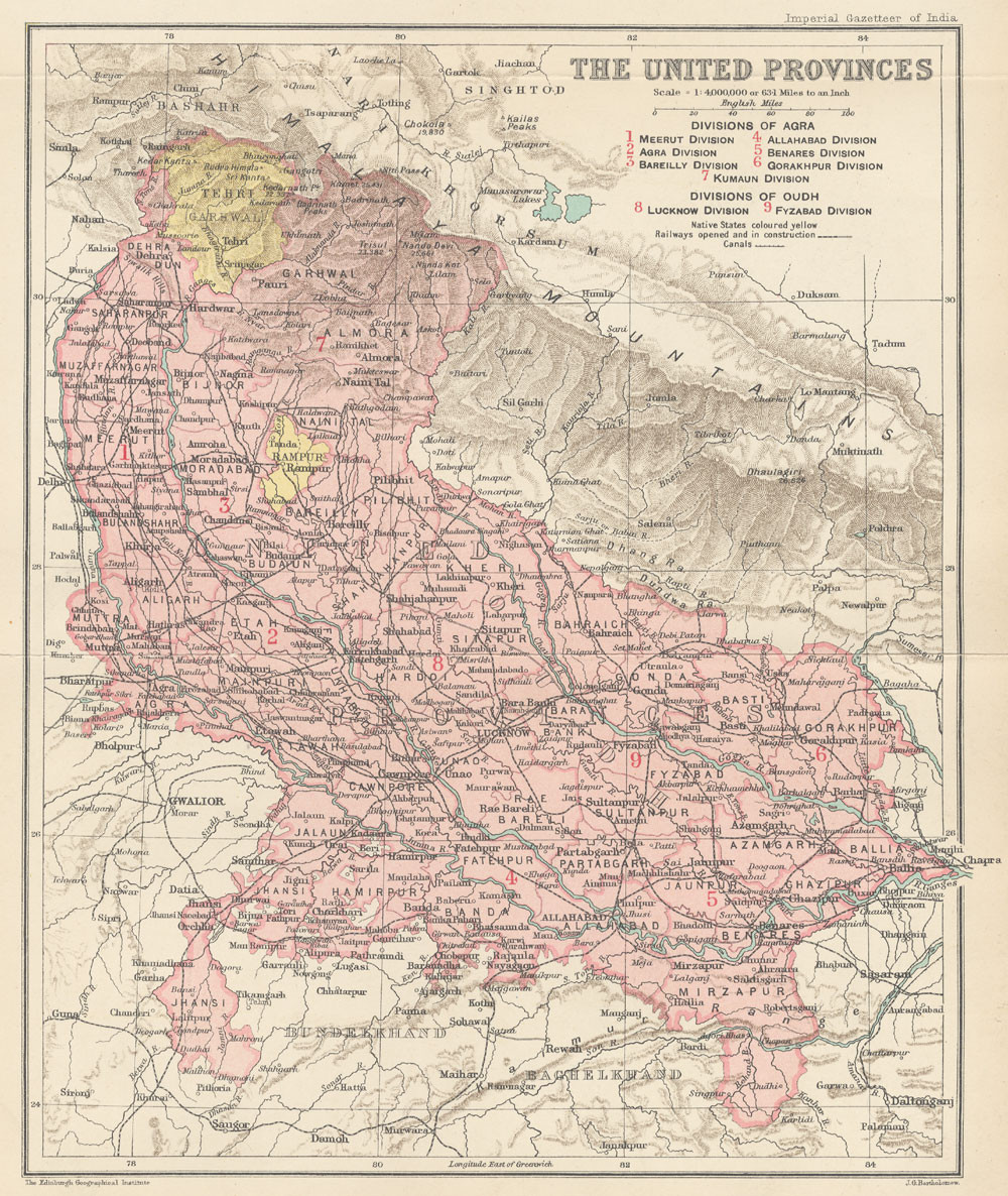
| விளக்கம் |
English: This is the map of Tehri Garhwal state made by British cartographer John G Bartholomew |
| நாள் | 1907 - 1909 |
| மூலம் | https://dsal.uchicago.edu/maps/gazetteer/images/gazetteer_V24_pg250.jpg |
| ஆசிரியர் | John G Bartholomew |
அனுமதி
The author died in 1920, so this work is in the public domain in its country of origin and other countries and areas where the copyright term is the author's life plus 100 years or fewer. | |
| This file has been identified as being free of known restrictions under copyright law, including all related and neighboring rights. | |
கோப்பின் வரலாறு
குறித்த நேரத்தில் இருந்த படிமத்தைப் பார்க்க அந்நேரத்தின் மீது சொடுக்கவும்.
| நாள்/நேரம் | நகம் அளவு சிறுபடம் | அளவுகள் | பயனர் | கருத்து | |
|---|---|---|---|---|---|
| தற்போதைய | 12:19, 23 சூலை 2020 | | 514 × 350 (70 KB) | Abhishek0831996 | |
| 12:00, 23 சூலை 2020 |  | 360 × 316 (44 KB) | Abhishek0831996 | Uploaded a work by John G Bartholomew from https://dsal.uchicago.edu/maps/gazetteer/images/gazetteer_V24_pg250.jpg with UploadWizard |
கோப்பு பயன்பாடு
பின்வரும் பக்க இணைப்புகள் இப் படிமத்துக்கு இணைக்கபட்டுள்ளது(ளன):
கோப்பின் முழுமையான பயன்பாடு
கீழ்கண்ட மற்ற விக்கிகள் இந்த கோப்பை பயன்படுத்துகின்றன:
- bn.wikipedia.org-திட்டத்தில் இதன் பயன்பாடு
- de.wikipedia.org-திட்டத்தில் இதன் பயன்பாடு
- en.wikipedia.org-திட்டத்தில் இதன் பயன்பாடு
- hi.wikipedia.org-திட்டத்தில் இதன் பயன்பாடு
- id.wikipedia.org-திட்டத்தில் இதன் பயன்பாடு
- ja.wikipedia.org-திட்டத்தில் இதன் பயன்பாடு
- ne.wikipedia.org-திட்டத்தில் இதன் பயன்பாடு
- pnb.wikipedia.org-திட்டத்தில் இதன் பயன்பாடு
- uk.wikipedia.org-திட்டத்தில் இதன் பயன்பாடு
- ur.wikipedia.org-திட்டத்தில் இதன் பயன்பாடு