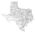
படிமம்:Texas counties map.png

இந்த முன்னோட்டத்தின் அளவு: 628 × 599 படப்புள்ளிகள் . மற்ற பிரிதிறன்கள்: 251 × 240 படப்புள்ளிகள் | 503 × 480 படப்புள்ளிகள் | 1,010 × 964 படப்புள்ளிகள் .
மூலக்கோப்பு (1,010 × 964 படவணுக்கள், கோப்பின் அளவு: 49 KB, MIME வகை: image/png)
கோப்பின் வரலாறு
குறித்த நேரத்தில் இருந்த படிமத்தைப் பார்க்க அந்நேரத்தின் மீது சொடுக்கவும்.
| நாள்/நேரம் | நகம் அளவு சிறுபடம் | அளவுகள் | பயனர் | கருத்து | |
|---|---|---|---|---|---|
| தற்போதைய | 15:02, 23 ஏப்பிரல் 2010 |  | 1,010 × 964 (49 KB) | Buaidh | {{Information |Description={{en|1=A map of the 254 counties of the State of Texas.}} |Source=U.S. government |Author=U.S. government |Date=2010-04-23 |Permission={{OTRS pending|month=April|day=23|year=2010}} |other_versions=Texas_counties_map.gif }} [[Ca |
கோப்பு பயன்பாடு
பின்வரும் பக்க இணைப்புகள் இப் படிமத்துக்கு இணைக்கபட்டுள்ளது(ளன):
கோப்பின் முழுமையான பயன்பாடு
கீழ்கண்ட மற்ற விக்கிகள் இந்த கோப்பை பயன்படுத்துகின்றன:
- en.wikipedia.org-திட்டத்தில் இதன் பயன்பாடு
- ja.wikipedia.org-திட்டத்தில் இதன் பயன்பாடு
