படிமம்:William Faden. European Dominions of the Ottomans or Turkey in Europe. 1795.jpg

மூலக்கோப்பு(2,167 × 1,630 படவணுக்கள், கோப்பின் அளவு: 3.91 MB, MIME வகை: image/jpeg)

இது விக்கிமீடியா பொதுக்கோப்பகத்தில் இருக்கும் ஒரு கோப்பாகும். இக்கோப்பைக் குறித்து அங்கே காணப்படும் படிம விளக்கப் பக்கத்தை இங்கே கீழே காணலாம்.
பொதுக்கோப்பகம் ஒரு கட்டற்ற கோப்புகளின் சேமிப்பகமாகும். நீங்களும் உதவலாம்.

சுருக்கம்

விளக்கம்
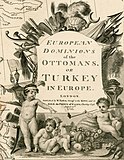
English: European Dominions of the Ottomans or Turkey in Europe . . . 1795.

Large detailed Faden map of the region bounded by the Greece and the Ionian Sea, the Ukraine, the Gulf of Venice, Asia Minor and the northern coast of Cyprus.

Extremely detailed. The map shows the Ottoman Empire, circa 1720 and includes and ornate decorative cartouche. This is the first state of the map.
நாள்
மூலம் Barry Lawrence Ruderman Antique Maps Inc.
ஆசிரியர்
William Faden  (1749–1836)  wikidata:Q8008902
 
மாற்று பெயர்கள்
Faden & Jefferys
விளக்கம் British cartographer உம் publisher
பிறந்த/இறந்த தேதி circa 1750
date QS:P,+1750-00-00T00:00:00Z/9,P1480,Q5727902
21 மார்ச்சு 1836 Edit this at Wikidata
பிறந்த/இறந்த இடம் இலண்டன் Shepperton
வேலைக்கான இடம்
From 1771: "Geographer to the King and to the Prince of Wales"
அதிகாரக் கட்டுப்பாடு
creator QS:P170,Q8008902
ஒத்தக்கோப்பு


அனுமதி

This is a faithful photographic reproduction of a two-dimensional, public domain work of art. The work of art itself is in the public domain for the following reason:
Public domain

This work is in the public domain in its country of origin and other countries and areas where the copyright term is the author's life plus 100 years or fewer.


You must also include a United States public domain tag to indicate why this work is in the public domain in the United States.
The official position taken by the Wikimedia Foundation is that "faithful reproductions of two-dimensional public domain works of art are public domain".
This photographic reproduction is therefore also considered to be in the public domain in the United States. In other jurisdictions, re-use of this content may be restricted; see Reuse of PD-Art photographs for details.

Captions

Add a one-line explanation of what this file represents

கோப்பின் வரலாறு

குறித்த நேரத்தில் இருந்த படிமத்தைப் பார்க்க அந்நேரத்தின் மீது சொடுக்கவும்.

நாள்/நேரம்நகம் அளவு சிறுபடம்அளவுகள்பயனர்கருத்து
தற்போதைய04:56, 14 மே 201104:56, 14 மே 2011 இலிருந்த பதிப்புக்கான சிறு தோற்றம்2,167 × 1,630 (3.91 MB)Geagea== {{int:filedesc}} == {{Information |Description={{en|1=William Faden: European Dominions of the Ottomans or Turkey in Europe . . . 1795.<br /> Large detailed Faden map of the region bounded by the Greece and the Ionian Sea, the Ukraine, the Gulf of Ven

பின்வரும் பக்க இணைப்புகள் இப் படிமத்துக்கு இணைக்கபட்டுள்ளது(ளன):

கோப்பின் முழுமையான பயன்பாடு

கீழ்கண்ட மற்ற விக்கிகள் இந்த கோப்பை பயன்படுத்துகின்றன:

  • en.wikipedia.org-திட்டத்தில் இதன் பயன்பாடு
மேனிலைத் தரவு